
Trace a Lubbock County Street
A street search works best as a chain of public records, not as a household list. First, confirm how mail recognizes the address. Then use the appraisal record and City map to tie that address to a parcel and its legal description. The Lubbock County Clerk recording index can connect that description to deeds and related filings. Historic directories may add a dated household clue. Each source answers a narrower question, and none alone proves who is present at an address today.
- Use the USPS ZIP Code Lookup to normalize the mailing address. Its result does not establish that a person or business is at that address.
- Search Lubbock Central Appraisal District by street number, street name, city, or ZIP. Save the Property ID, CAD ID, situs address, owner display, and legal description.
- Open the City GIS web-app directory for parcel geometry, street centerlines, city limits, ZIP context, and subdivision or neighborhood layers.
- Use the legal description and owner name in EagleWeb. Search grantor and grantee separately, preserve the reception number, and use Find Related when an instrument points to another record.
- For a historic snapshot, compare a directory address section with its alphabetical entry. County voter products have separate lawful request channels, but the inspected research did not establish a public by-street display.
That sequence avoids a common error. An LCAD card is an appraisal record, not a title opinion, and a recorded owner can be a trust, estate, company, or past owner. When identity rather than address history is the question, use the Lubbock County resident lookup for the separate name-and-record workflow.
Lubbock County Street Directory at LCAD
LCAD is the strongest countywide starting point for an address. Its result pattern lists Property ID, Account, Owner Name, Situs Address, and Value. The detail view can include the owner display, situs, legal description, value or tax-year information, exemptions, bills, map, and print state. Record the exact string shown, including directional wording. A small difference in a street form can prevent a later match in a deed index or an older directory.
The key distinction is mailing address versus situs address. The situs is the property location shown on a record, which can differ from where tax correspondence is sent. An exemption is not conclusive proof that someone occupies a property. Compare the appraisal card with the latest recorded instrument instead of silently treating the two systems as the same thing. LCAD also reports that property information changes as it is made, making the date viewed worth recording.
Note: LCAD’s public search supports discovery, while its historical online cutoff was not located in the inspected sources.
LCAD Fields for Street Searches
The advanced LCAD form gives an address researcher more choices than a single owner-name query. Start with the address fields before trying owner or legal-description fields. If a street search returns too many parcels, narrow it with city, ZIP, property type, status, tax year, or the street-number range. The research did not confirm which controls are required on the live form, so a blank result should be treated as a search limitation, not proof that no parcel exists.
| LCAD field | Search role | Required status | Research-supported options |
|---|---|---|---|
| Property ID / CAD ID | Identifier lookup | Not stated | Use the saved parcel identifier |
| Street-number range | Address range | Not stated | Pair with street name |
| Street name, city, ZIP | Location filters | Not stated | Use the normalized mailing form |
| Owner or business name | Party search | Not stated | Check variants separately |
| Abstract/subdivision, block, tract/lot | Legal-description search | Not stated | Useful when the street form fails |
| Property type, status, tax year, acreage | Result filter | Not stated | Real Property and other listed types |
Property type choices documented in the research are Real Property, Manufactured Home, Natural Resource, and Personal Property. LCAD also lists neighborhood, owner ID, acreage range, and a results display. These fields are useful for sorting a large street result, but they do not create a public roster of residents. Save an identifier before moving to the Clerk, because the exact legal-description wording may be more durable than the address.
Lubbock County Streets in GIS
City GIS adds the spatial context that an appraisal card does not show. The available layers include Address, Street Name, Parcel, Street Centerlines, Street Address Direction, Subdivision Name, Platted Subdivision, City Limit, ZIP Code, Lubbock County, Building Footprint, parks, flood zone, and neighborhood associations. Use them to decide whether two similar addresses share a parcel pattern, subdivision, or city-limit setting. The map is a reference tool, not a certified boundary or legal description.
The City ParcelMap service shows the parcel-layer inventory used for this Lubbock County street directory.
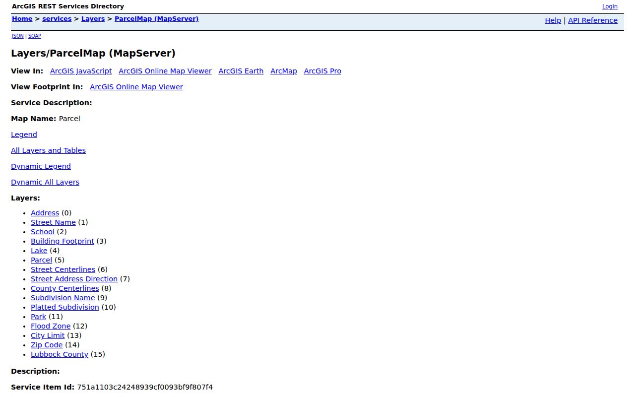
Use the map alongside LCAD and the Clerk’s records. The inspected material did not establish live GIS search fields, buffer tools, result counts, or popup behavior, so do not assume that the viewer can browse every address on a street in one action. Its street and parcel layers remain helpful for confirming direction, ZIP context, and city-limit setting before requesting an official record.
Address Records for Lubbock Streets
Different keepers hold different pieces of an address trail. The table separates what each record set can support from what it cannot. It also shows the fallback path when an online index is incomplete. A street directory search may start online, but courthouse, archive, library, and narrowly written public-information requests remain important access channels in Lubbock County.
| Address record | Local keeper | Useful clue | Access path |
|---|---|---|---|
| USPS address result | USPS | Mailing normalization and ZIP | By Address lookup, not occupancy proof |
| Parcel and appraisal card | LCAD | Situs, owner display, value, identifiers | Online address or owner search |
| Parcel and street map | City GIS | Geometry, centerlines, limits, ZIP, subdivision | Parcel Viewer or REST layers |
| Recorded instruments | County Clerk | Deeds, liens, plats, reception number | EagleWeb, courthouse, or copy request |
| Directory address section | TSL, TTU, library | Dated occupant or telephone clue | Selected years and reels; holdings vary |
| Voter data products | County Elections / SOS | Registration fields and precinct products | Lookup or lawful data request |
| Permit or code record | City department | Public project or inspection record | City Public Information Act request |
Utilities and motor-vehicle address data are generally restricted and are not a public street lookup. For a City department record that is not online, describe the address, record type, department, date range, and preferred format in a City open-records request. Texas Government Code Chapter 552 is the Texas Public Information Act, but exceptions and redactions can apply. A complete public permit or code-search index was not located in the research.
EagleWeb Deeds Along Lubbock Streets
When an address needs a deeper history, the Lubbock County Clerk / EagleWeb Recorder is the bridge from an LCAD card to recorded instruments. Search grantor and grantee separately. Begin with a broad date range, then add document type. EagleWeb’s Basic mode fits known surname-first order; Advanced mode helps when word order is uncertain. Its help explains that an asterisk is a wildcard, while Advanced mode uses a plus sign to require a term and a minus sign to exclude one.
Open the likely purchase deed and preserve the grantor, grantee, reception number, recording date, document type, legal description, image or page reference if displayed, and the portal disclaimer. Find Related can locate filings that reference the current document or share its legal description. When a street address is absent, the lot, block, tract, or subdivision language is often the better bridge. The portal is a convenience index, not the official repository or a certification of authenticity.
The EagleWeb search-help page documents the grantor, grantee, reception, date, document-type, and related-search workflow.
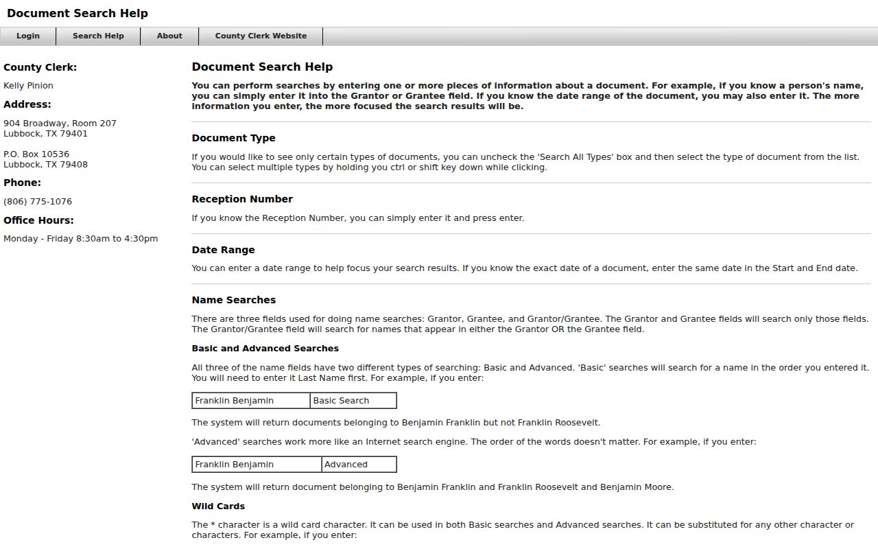
For a fact that needs an official copy, use the County Clerk or courthouse path. The research did not locate an online coverage start date, complete document-type list, image fee, or a live deed result, so those details should be verified before relying on them. Older books, microfilm, paper, and converted media may also require a named request through records management.
Lubbock Street Names and Limits
Historic addresses do not always line up cleanly with a current search form. The City maps page provides Official City Street Names and Block Ranges plus Historical Annexations by Decade and by Ordinance. Those resources can help when a directory uses an old block reference or when an address sits outside today’s city limit. They provide civic context, not a replacement for an address authority.
Exact quadrant rules, street-renumbering dates, old-to-new address pairs, and a complete historic city-limit timeline were not located in the official material inspected for this project. Keep both the historic and current form in research notes, then test the parcel legal description and map context before deciding they represent the same place. A city-limit map also does not establish a neighborhood’s legal boundary.
Note: Lubbock County’s preservation work and ongoing re-indexing may improve discovery of older records without making every legacy image available online.
Historic Clues on Lubbock Streets
Older directory material offers a dated address clue, not a current occupancy finding. The Texas State Library and partner holdings list Lubbock city directories for selected years from 1925 through 1959, a continuous 1960 to 1990 run, and 1992 to 1994. Texas Tech materials include a 1933 telephone directory and a 1984 ZIP item. Those are different source types, so record the edition, publication date, page, and the address form exactly as printed.
A criss-cross directory is a reverse-style directory organized by address instead of alphabetically by name. It can help connect a historic street entry to an individual listing, but the inspected research did not establish reverse-section holdings or a complete Lubbock run. Use the Lubbock County directory book for the collection-specific access path rather than assuming every year has an address section.
- Parcel
- A mapped unit of land tied to an appraisal or legal-description record.
- Situs address
- The property location shown on a record, which may differ from the owner’s mailing address.
- Plat
- A recorded map that lays out lots, blocks, streets, or subdivisions.
- Criss-cross directory
- An address-arranged directory used to work from a place toward an occupant clue.
Lubbock County Recording Alerts
The County Clerk’s Fraud Guard is a practical monitoring feature for recorded-name activity. A person registers a name and email, confirms the email, and can receive an alert when a document containing that name is recorded. It can be useful after a deed search reveals the names tied to an address, especially when a record needs prompt review.
The alert is not a title search and does not prevent fraud, guarantee detection, give legal advice, or remove a document. The Lubbock County Fraud Guard signup says a document can be reviewed in person at 904 Broadway or purchased online.
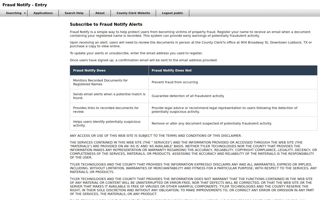
Use an alert as a prompt to inspect the underlying instrument, not as evidence about a household or a property interest. The alert is a monitoring lead, while the instrument and the County Clerk’s certified or plain-copy procedure supply the record itself.
Lubbock County Street Directory Limits
The Lubbock County street directory can help locate public parcel, map, recording, and historic-directory evidence. It cannot produce a reliable list of every person at an address. A deed may name only an owner or a legal entity. A voter-status result is a snapshot, and protected-address programs can use a substitute mailing address. A directory entry is dated evidence. Restricted utility and motor-vehicle data should not be inferred from a public record gap.
Lawful use. Use address records for lawful personal research, family-history work, property questions, or civic transparency. Do not use public data to stalk, harass, intimidate, or harm any person.
County record access has also changed with digitization, re-indexing, privacy safeguards, and online-service restoration. A no-result can reflect indexing, date range, jurisdiction, confidentiality, or an incomplete online image. Confirm important facts with the appropriate custodian, and preserve the source date and access method with every research note.