
Lubbock County ZIP Code Coverage
The City’s official ZIP reference gives Lubbock County a 32-code baseline. It is the best local list for deciding which postal labels should be checked, but it is not a parcel map and does not assign every street or household to a civic area. Several entries are marked special, box, institutional, or outlying because the inspected local source did not establish their precise delivery purpose. Those labels are kept cautious here rather than converted into unsupported neighborhood names.
| Postal ZIP | Local area note | Post-office status | Record-search caution |
|---|---|---|---|
| 79243 | Included in the City county list | Verify with USPS | Service-area place not identified |
| 79329 | County or outlying postal area | Verify with USPS | City or route name not confirmed |
| 79350 | New Deal area | Verify delivery point | Do not infer city boundary |
| 79363 | Shallowater area | Verify delivery point | Use an address match |
| 79364 | Slaton area | Verify with USPS | Not a city boundary |
| 79366 | Ransom Canyon area | Verify delivery point | Use an address match |
| 79382 | Wolfforth area | Verify with USPS | May span civic context |
| 79401 | Central Lubbock or downtown postal area | Verify exact delivery | Boundaries require USPS |
| 79402 | Postal or box and central area | Not separately identified | Do not assume street delivery |
| 79403 | North or east Lubbock area | Verify exact delivery | Use a street-level match |
| 79404 | East or southeast Lubbock area | Verify exact delivery | 2023 label change affects searches |
| 79406 | Texas Tech vicinity | Verify with USPS | Not a university boundary |
| 79407 | West, northwest, or Reese vicinity | Verify exact delivery | Check city or county edge |
| 79408 | Postal or box area | Not separately identified | Not a parcel boundary |
| 79409 | Lubbock or Texas Tech postal area | Not separately identified | Delivery purpose not confirmed |
| 79410 | Central or south-central Lubbock | USPS controls match | Use address result |
| 79411 | Postal or box area | Not separately identified | Do not infer household area |
| 79412 | South or east Lubbock area | Verify exact delivery | 2023 label change affects searches |
| 79413 | South-central Lubbock area | Verify exact delivery | Use parcel-level label |
| 79414 | Southwest Lubbock area | Verify with USPS | Postal boundary only |
| 79415 | South or southeast county edge | Verify municipality | Check delivery city separately |
| 79416 | Northwest Lubbock area | Verify exact delivery | Use address lookup |
| 79423 | South or east Lubbock and county edge | Verify exact delivery | Related to 79452 label change |
| 79424 | Southwest Lubbock or Wolfforth edge | Verify with USPS | May cross city limits |
| 79430 | Special, box, or institutional use | Not exposed locally | Service type not confirmed |
| 79452 | Special, box, or outlying use | Verify exact delivery | Related to 79423 label change |
| 79457 | Special, box, or outlying use | Not exposed locally | County mailing use is not parcel proof |
| 79464 | Special, box, or outlying use | Not exposed locally | Service type not confirmed |
| 79490 | Special, box, or outlying use | Not exposed locally | Service type not confirmed |
| 79491 | Special, box, or outlying use | Not exposed locally | Service type not confirmed |
| 79493 | Special, box, or outlying use | Not exposed locally | Service type not confirmed |
| 79499 | Special, box, or outlying use | Not exposed locally | Service type not confirmed |
The Texas General Land Office postal list confirms many Lubbock labels and includes 79489, while the City list includes 79490 and 79243. That is a difference in source definitions, not a reason to substitute one label for another without a delivery-point check. The Lubbock County ZIP code directory therefore preserves the City’s stated 32-code baseline and flags the discrepancy.
Every Lubbock County ZIP Code
The official baseline is useful for a broad county search because it includes both 794xx postal areas and outlying labels. The 79329, 79350, 79363, 79364, 79366, 79382, and 79243 entries should not be treated as an urban Lubbock-only group. Likewise, box and special-use labels cannot reliably be assigned to a resident location. Search a full address through USPS before applying a ZIP to a parcel or historical record.
USPS provides By Address, By City and State, and Cities by ZIP paths. On the address path, Company is optional, Street Address is required, and the user can provide city and state or a ZIP. The result supplies a normalized mailing format. USPS warns that it does not prove a person or company is located there, which makes it a routing check rather than an identity record.
Note: The City list provides a county baseline, while the postal service determines the label for a specific delivery point.
Lubbock ZIP Code Labels Changed
A November 1, 2023 USPS bulletin recorded mailing-label changes relevant to Lubbock County: 79404 to Lubbock 79401, 79412 to 79410, and 79423/79452 to 79423. These are label changes. They do not prove that a property, city limit, parcel, school zone, or neighborhood boundary moved. Historic documents can still carry an earlier label, so preserve the source date and search both forms when the record date is close to the change.
This ZIP-code detail matters most when an address appears in a directory, receipt, map, or deed note with a label that differs from the current USPS result. Keep the legal description and parcel identifiers with the address. They are more useful than a postal label for deciding whether two records concern the same land.
Search Lubbock County by ZIP
A ZIP is a productive filter for property and map context, but local records do not all accept it in the same way. LCAD documents a ZIP field in advanced property search. City GIS provides a ZIP Codes layer. USPS confirms a delivery label. The inspected VoteTexas material did not establish a ZIP search field, and county voter products are described by countywide, precinct, entity, district, or election-history selections rather than as a public ZIP directory.
- Run the full address through USPS ZIP Code Lookup and save the normalized mailing form.
- Use the ZIP field in LCAD advanced search, then narrow further with street, city, property type, status, or tax year when needed.
- Compare the result with the City’s GIS ZIP layer and parcel context. A map layer may show a postal area without resolving ownership or occupancy.
- For voter or election questions, contact the County Elections office or VoteTexas through the documented status and data-request routes. Do not assume ZIP is a supported query field.
Once a ZIP narrows the place, the Lubbock County street directory has the address-by-address parcel and deed sequence. It is better suited to a named street than a ZIP-wide search.
Lubbock ZIP Code Search Fields
LCAD’s advanced form can combine a ZIP with address and legal-description fields. This is a property search, not a list of current residents. The observed research names the controls but does not state which are mandatory, reveal their current dropdown values, or establish a historical cutoff. Start narrowly enough to avoid a broad result, then save the identifiers that connect the property card to the Clerk’s recording index.
| LCAD field | Field type | Required status | ZIP-search use |
|---|---|---|---|
| ZIP | Location filter | Not stated | Postal-area starting filter |
| Street-number range | Address range | Not stated | Narrows a ZIP result |
| Street name and city | Location filters | Not stated | Matches the USPS form |
| Property ID / CAD ID | Identifier lookup | Not stated | Preserves a selected parcel |
| Property type, status, tax year | Result filters | Not stated | Refines a broad ZIP result |
| Subdivision, block, tract/lot | Legal-description fields | Not stated | Bridges map and deed records |
LCAD also documents owner name, business name, owner ID, neighborhood, abstract or subdivision code and name, acreage range, and results display. An owner mailing address can differ from the property situs. Confirm any ownership question with the Lubbock County Clerk recording path instead of treating an appraisal display as certified title evidence.
Lubbock County ZIP Map Context
The City GIS ZIP layer is derived from a hardcopy city drawing and exposes a ZIPCODE field with query, GeoJSON, and PBF options. It gives a useful visual reference for the City portion of the county. Parcel geometry, street centerlines, city limits, subdivision layers, and county context are separate map records. Comparing them helps explain why a postal label may not match a civic label.
The City GIS ZIP Codes layer is the source represented in this Lubbock County ZIP code directory.
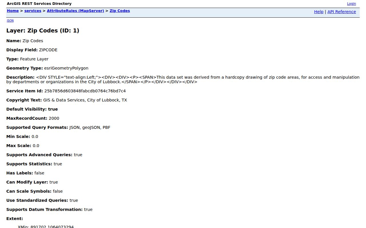
The image shows a GIS service layer, not a delivery confirmation. Use USPS for the mailing label, City GIS for spatial context, and LCAD or the County Clerk for parcel and recording details.
ZIP Codes Beyond Lubbock Limits
ZIP boundaries and city limits disagree by design. A postal ZIP can reach a county edge or a nearby municipality, while a city-limit line is a civic boundary. The 79424 area, for example, is described as a southwest Lubbock and Wolfforth edge with postal service that may cross city limits. The 79364 Slaton entry is included in the county list but is expressly not a city boundary. Use the parcel location and current address result before assigning a municipality.
Census ZIP Code Tabulation Areas, or ZCTAs, are statistical approximations rather than USPS delivery areas. The Census profile reports several 79382 and 794xx ZCTAs fully or partly within city geography. Neither a ZCTA nor a ZIP should be used alone to assign a voter precinct, school zone, utility district, neighborhood, or legal municipality. The inspected research did not identify a named County E911 addressing authority or a formal readdressing crosswalk.
Boundary caution. A ZIP code is a postal routing area. Verify a specific address with USPS and use the parcel, city-limit, and legal-description records for civic or property questions.
Lubbock County ZIP Code Terms
Postal vocabulary can look more exact than it is. The terms below keep a Lubbock County ZIP code result in the right context. They also explain why an address search may need USPS, City GIS, and a parcel record rather than a single lookup.
- ZIP and ZIP+4
- A ZIP routes mail to a broader postal area. ZIP+4 adds a delivery-segment detail and does not define a parcel or city boundary.
- PO-box ZIP
- A ZIP used for post-office-box service may not describe a street-delivery area or household location.
- Unique ZIP
- A ZIP associated with one organization or special delivery purpose. The inspected local source did not establish a specific Lubbock County unique ZIP.
- Carrier route
- A postal delivery grouping. It is not a public resident roster or a legal geography.
- ZCTA
- A Census statistical approximation of ZIP geography, not a replacement for USPS delivery data.
For an older address, retain its printed ZIP and compare it with the current USPS response rather than overwriting one with the other. The date, parcel identifiers, legal description, and source type together make a stronger record trail than a postal label alone.